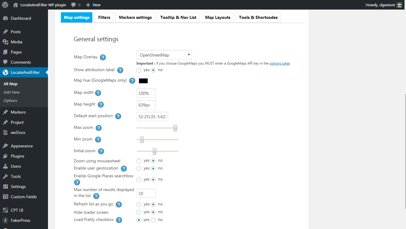
1 Map Overlay – Recommend use OpenStreetMap, without API key
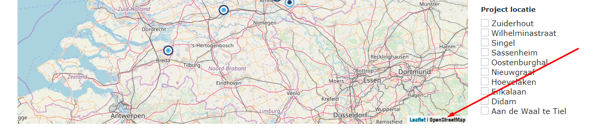
2 Show attribution label
The attribution label is displayed on the bottom right side of the map. It states the source of the overlay you are using, for example OpenStreetMap
3 Map width
This setting will determine the width of the map if no predefined layout is used.Please note that this setting doesn’t apply to maps generated using the [ LocateAndFilter map_id=… ] shortcode
Pixels and % supported.
4 Map height
This setting will determine the height of the map if no predefined layout is used. Please note that this setting doesn’t apply to maps generated using the [ LocateAndFilter map_id=… ] shortcode
Pixel is the only unit supported
5 Max zoom
This setting will determine the maximum zoom allowed for this map.
6 Min zoom
This setting will determine the minimum zoom allowed for this map.
7 Initial zoom
This setting will determine the initial zoom for this map.
You can set it manually or just zoom the preview map to the desired zoom level
8 Enable user geolocation
If this parameter is set to “yes” the plugin will try to locate the user and center the map on his current location
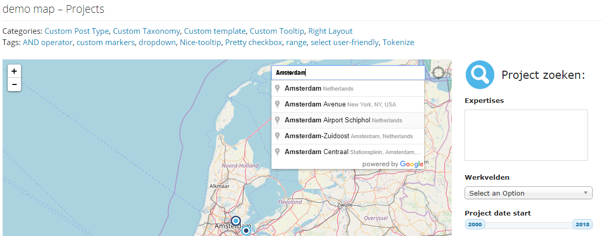
9 Enable Google Places searchbox
Set this parameter to “yes” to add a a Google Places searchbox to this map
10 Max number of results displayed in the list
This setting will determine the maximum number of items in the navigation list of this map
11 Refresh list as you go
If this option is checked the navlist will only show the markers that are located in the bounds of the map. This means that for example if your map is zoomed and centered on NYC and your markers are in SF, the navlist will be empty
12 Hide loader screen

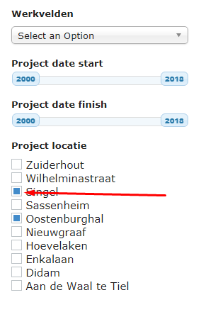
A pure CSS library to beautify checkbox and radio buttons